Images and Commentary:
Inca Public Works and Monumental Construction
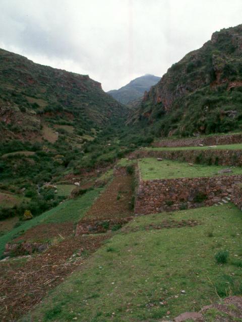
These images are suggestive of the scale of the building projects undertaken by the Inca regime aimed at increasing the food supply and storage capabilities. Food was the key to everything, it permitted the assembly and operation of large human organizations for work and war. Each of the three sites below were private estates used by Inca rulers, who were enabled to live amid considerable luxury and comfort by means of maintaining and controlling food production and stored surpluses. The residential and ceremonial precincts for use by high status officials and the facilities for the intensified agriculture, terraces and granaries, were all built by forced labor, under the mita, or rotational tributary system imposed by the Inca regime. An important question for our research is whether or not the use of forced or tributary rotational labor in these large scale projects was tending to increase over time approaching the pre-Hispanic epidemic of the 1520s.
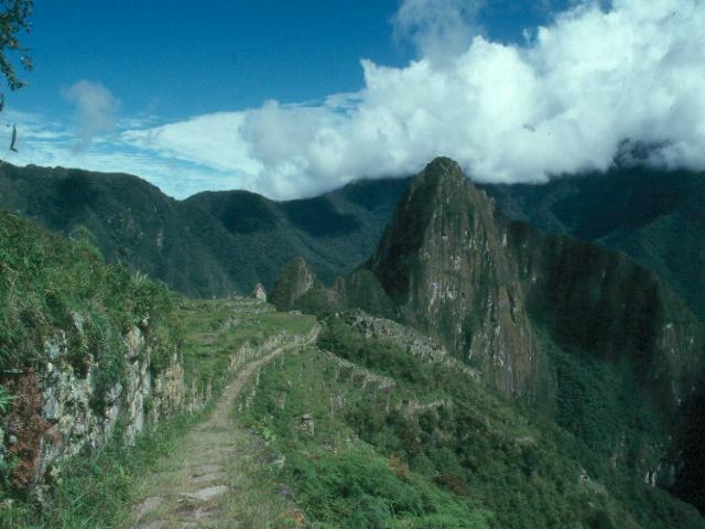
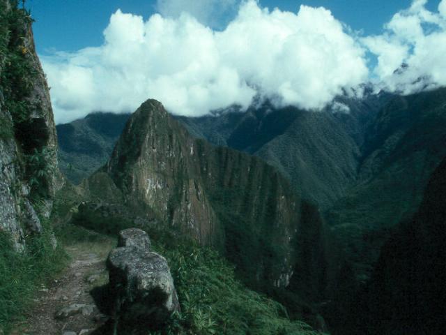
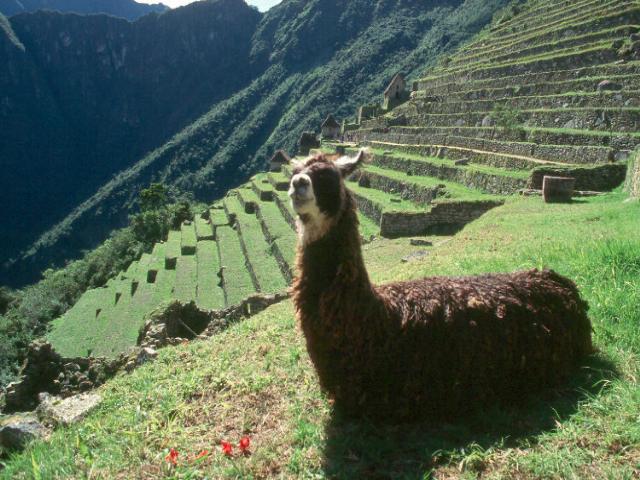
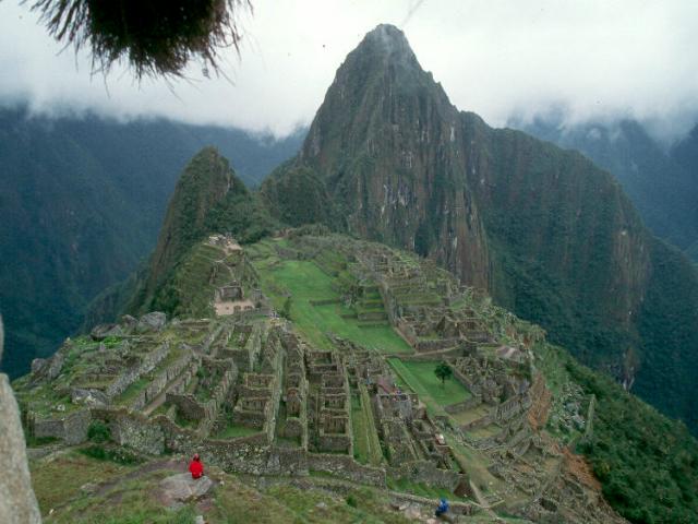
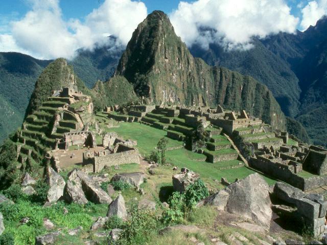
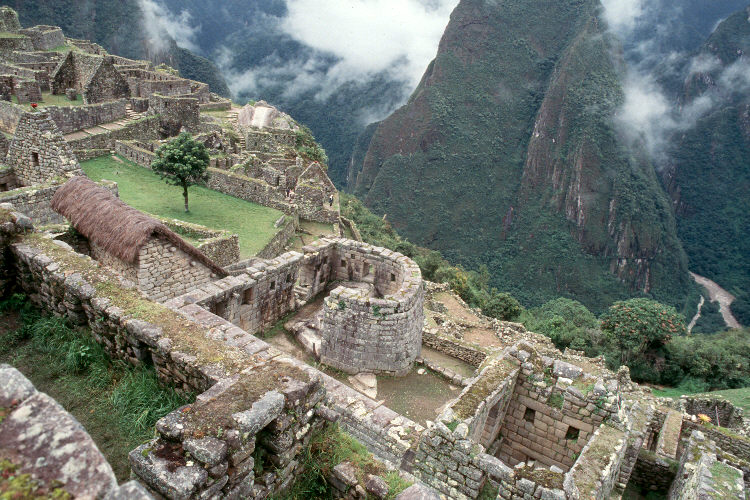
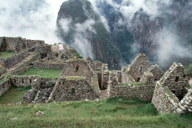
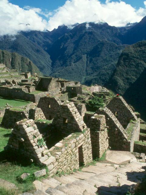
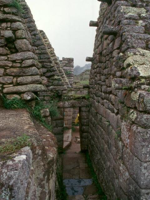
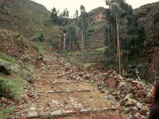
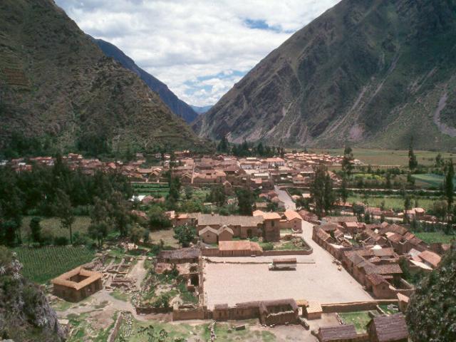
These are images of the Inca Road and urbanization at Machu Pichu, showing characteristic intensive terracing for on-site food production. Machu Pichu was believed to have been a summer residence or un-official residence for the Inca and his immediate retinue. It would have been a private estate rather than a public or state owned facility. Thus the food generated on site was not for use in any public assistance programs, rather it contributed to the wealth of the landlord, presumably the Inca. Although the site was never discovered by the Spanish during colonial times, it appears to have been abandoned before completion.
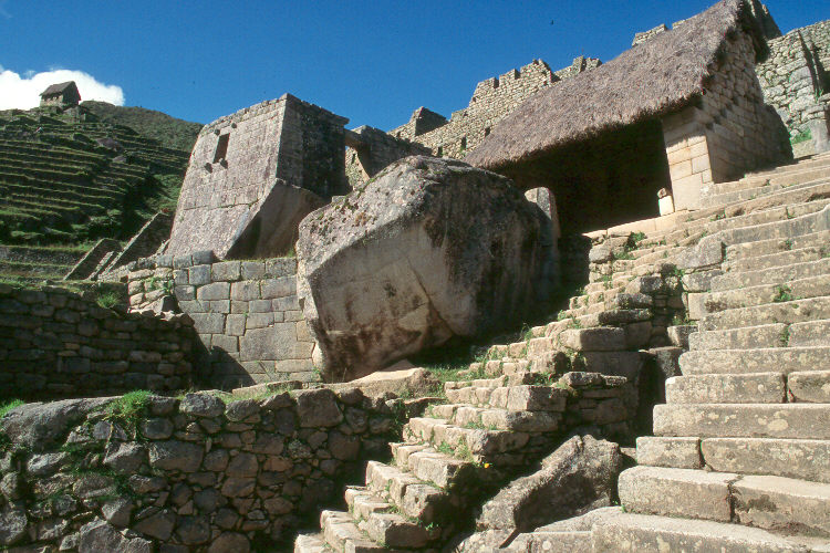
As can be seen from these images, the dwellings were small, and tightly packed into the site. Several types of stonework are present, perhaps, following Susan Niles's contention, reflecting differences in the status of the occupants or purposes of the buildings. The different techniques seen here show marked differences in the level of finish and tightness of fit in the stonework. In some cases the stone is extremely tightly fitted, in other cases much less so. Mud plaster and mud mortar was used in many places, especially where the finish was of a lower category.
The sandfly was a vector of disease in pre-Columbian times, so an important question for our research is whether the installation of large scale complexes such as this at Machu Pichu afforded previously unavailable habitat to sandfly types capable of transmitting disease to humans. It is known that some of the sandfly types that might carry disease are lizard feeders. Would these various types of stone walls and mud plastering have provided habitat for an expanding lizard population? And another important question is whether these types of lizard feeding sandflies might also be capable of feeding on humans if suddenly there were large concentrated human populations living in and among in small, tightly packed stone buildings. If the lizard population grew, and so also the sandfly population, could a human infected elsewhere arriving after a journey on the Inca Road have infected the sandfly population, and so passed a disease on to the lizard and/or human population?
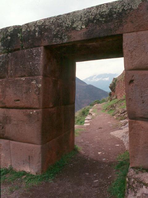
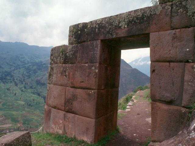
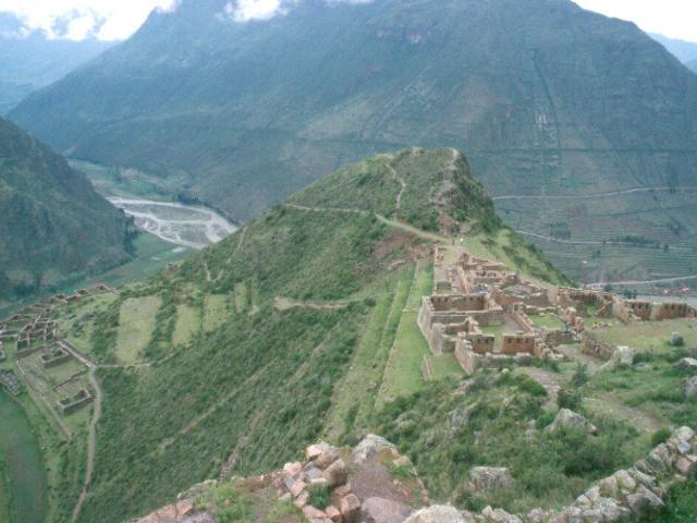
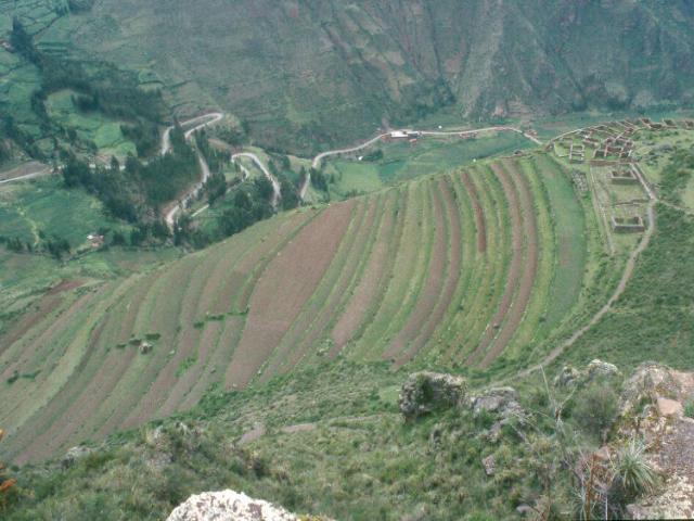
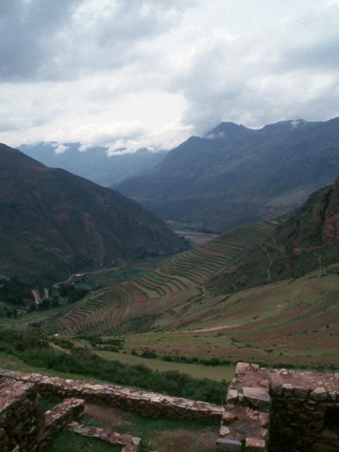
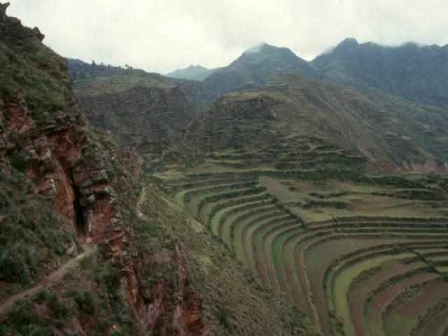
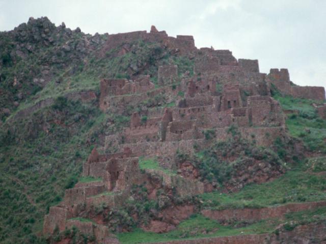
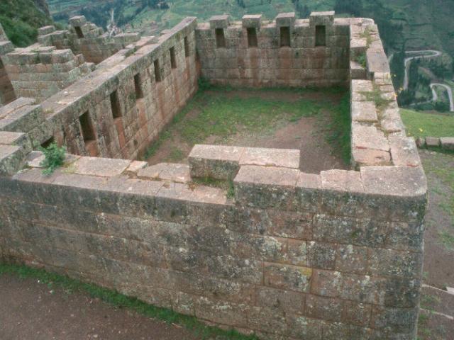
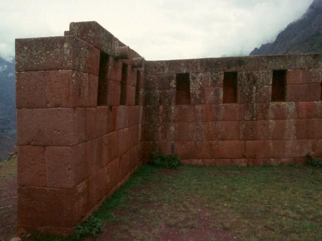
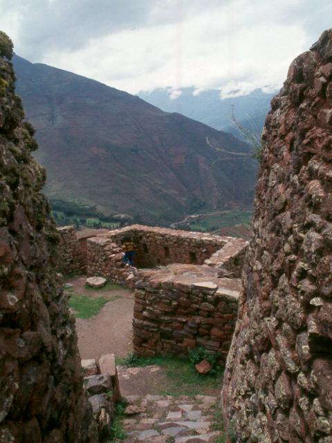
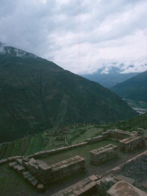
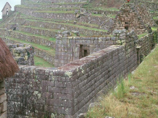
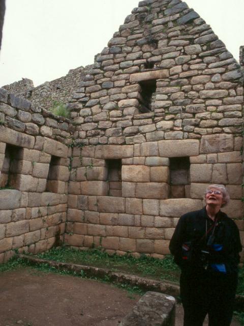
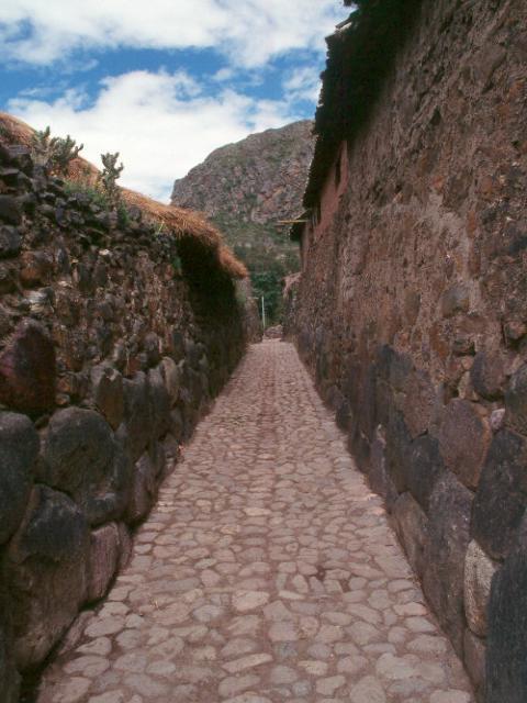
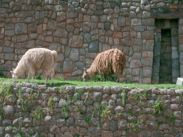
The images above are of Pisac, another Royal estate whose revenues would have contributed to the wealth of the owner for his benefit during his lifetime and for the maintenance of his mummy thereafter.
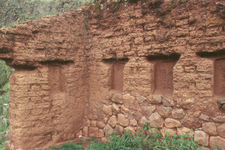
Again, at Pisac, we see stone work in several categories, as well as the use of adobe mixed with stone work in a lower status building. The use of adobe was common in construction of this kind. In the small urbanizations near the high status compound the buildings are, again tightly packed with narrow passages between them. Would humans walking in these narrow passages be subject to sandfly attack, even though the flight ranges of the sandflies in question might be limited?
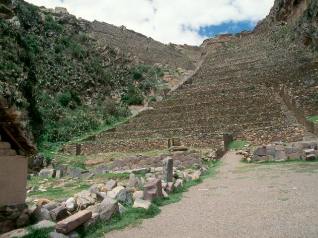
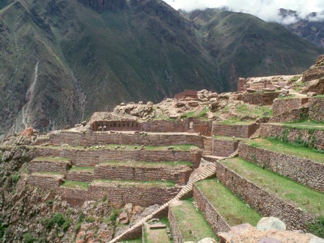
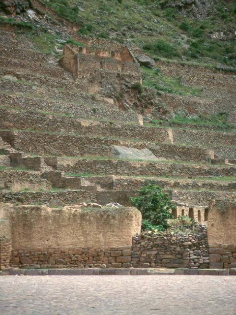
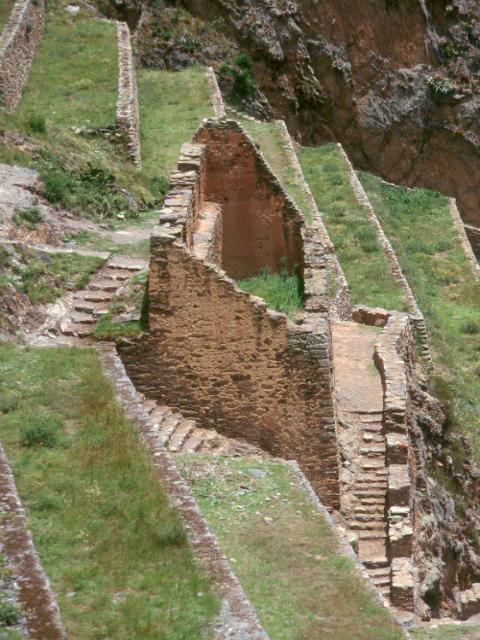

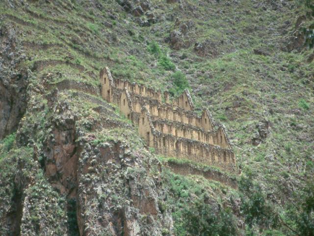
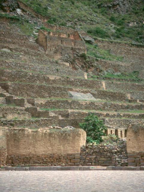
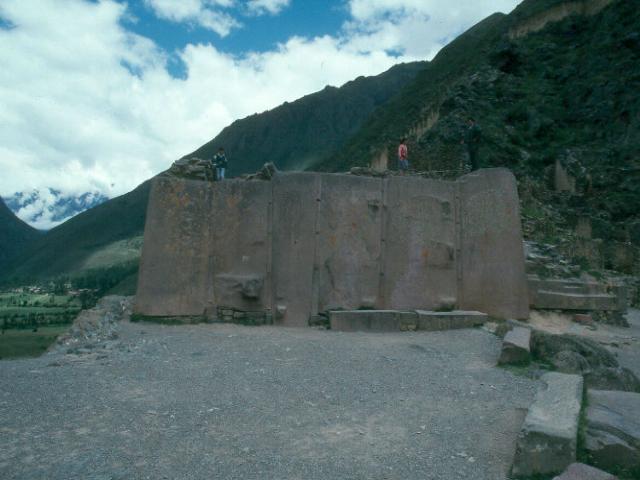
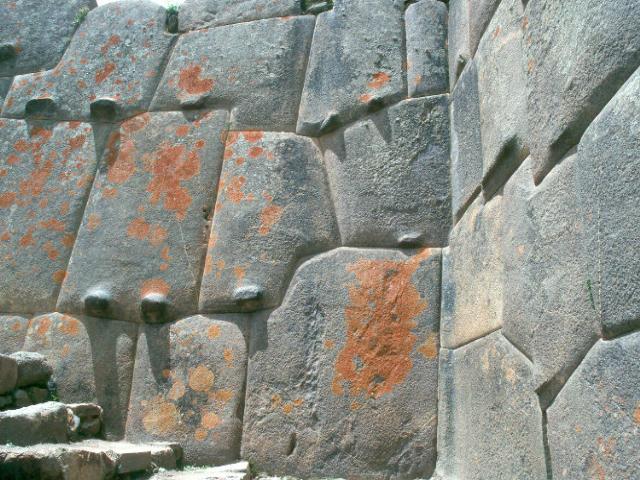
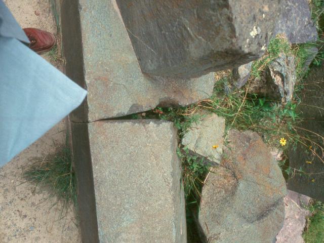
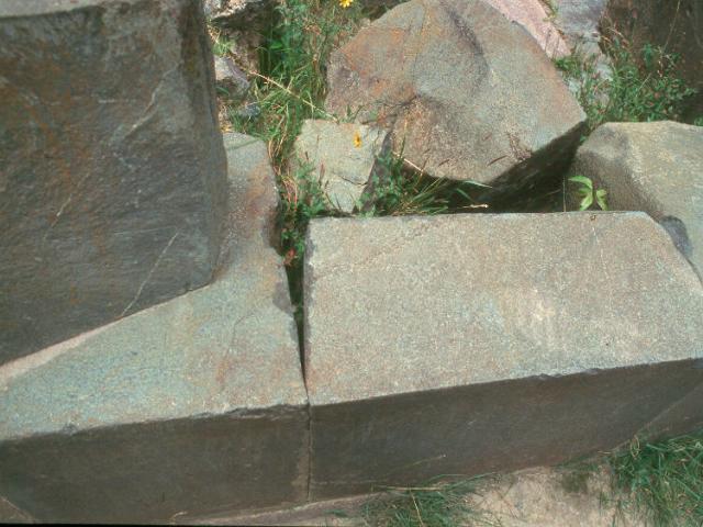
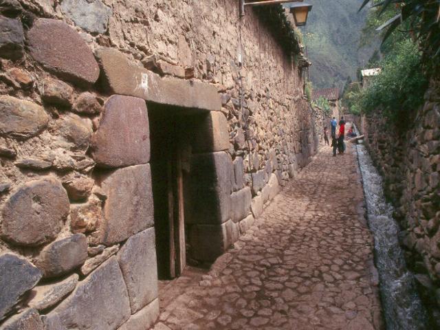
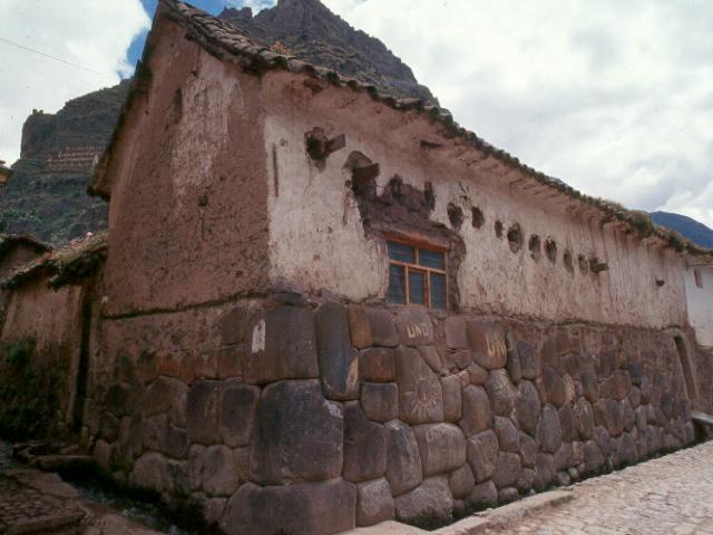
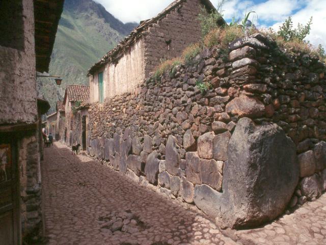
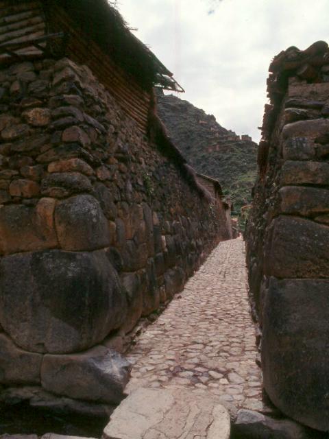
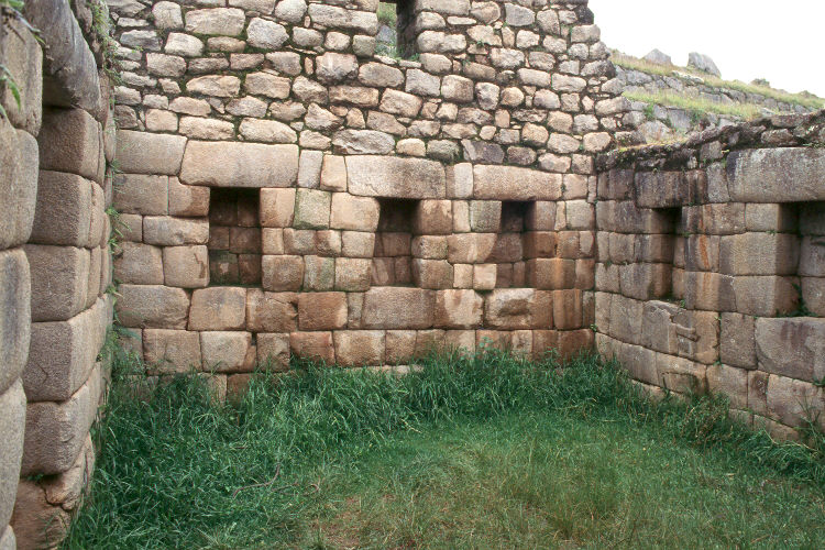
This is Ollantaytambo, personal estate of Pachacuti Inca. The site combines a ceremonial precinct with intensive terracing for food production together with an elaborate array of storage buildings of two types, as seen in these images. The food was probably contained in ceramic vessels such as those pictured below, and probably included shelled maize and perhaps tubers of some kind, although the temperatures at Ollantaytambo were generally too warm for effective long term storage of tubers, which were highly susceptible to rot and fungus attacks. It may be that maize was grown on the terraced hillsides for the official class and that the tubers were grown on the valley floor for the workers. The tubers may have been consumed on site as rapidly as they were produced. Further study of this important issue may clarify this point. The extraordinary ceremonial center was never completed. Very large blocks of pink granite, six meters long by 1.5 meters by 1.5 meters weighing many tons were quarried for this project at a site 12 miles distant, on the slopes of mountains on the opposite side of the valley. In addition to the massive blocks that were installed, a train of other blocks being moved to the site--stretching at intervals all the way back to the mountainside quarry--were abandoned quite suddenly where they were. It is believed that this occurred at the moment of the Spanish invasion, which, according to the chronicles, finally overran the site. There were no traction animals anywhere in the Americas prior to the Spanish invasion. Protzen postulates that many thousands of human workers were involved in moving the materials for this building project. And, as can be seen from just the other sites illustrated above, it is important to remember that Ollantaytambo was by no means the only large scale building project involving the concentration of very large work forces engaged in extremely demanding physical labor. What is more, these work forces were in many cases of a rotational nature. That is, individuals would come for a specified period of mita, or tributary labor. Then they would return to their village. If they were infected at the time they returned to their village, could this labor system have contributed to the rapid spread of an epidemic? Could the concentration of so large a work force in numerous projects throughout the Inca Empire working under extreme stress amid highly intensified agricultural efforts to provide food for such a work force have contributed to an epidemic outbreak?
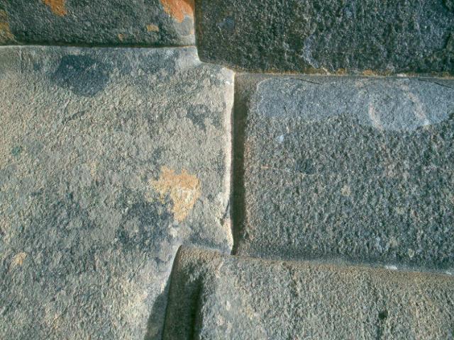
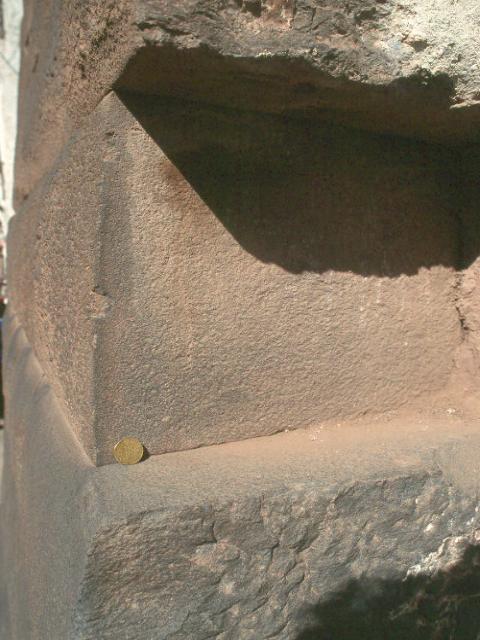
We can notice in these images, again, several kinds of stone work, from extremely tightly fitted high status work in the ceremonial precinct to lower status work in the village below. The tightly fitted work layed up in even courses was fitted tightly only at the face, and the stones were cut with a chamfer or bevel from the face back, providing a space for mud mortar, and perhaps sandfly habitat. We can also see rammed earth walls at the base of the terraces leading to the ceremonial area. Rammed earth was a building technique commonly used in the Inca area in pre-Columbian times. We can see, again, narrow streets with high walls of medium to low status stone work on either side. These walls with relatively loosely fitted stone would have been layed up with mud mortar and plastered with mud mortar, possibly providing habitat for sandflys.
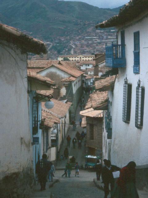
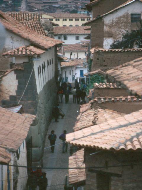
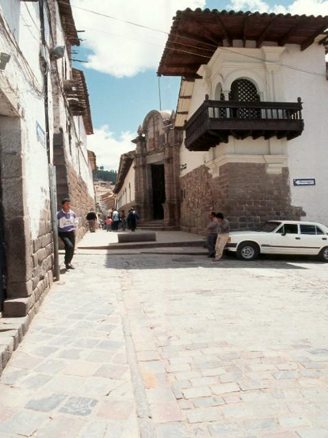

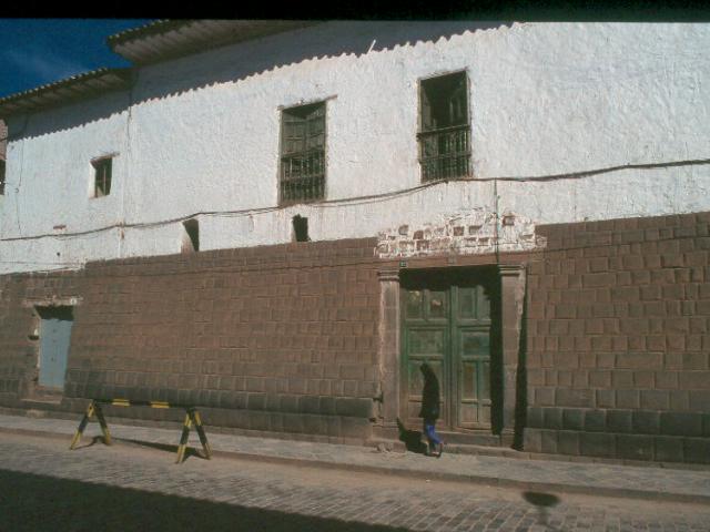
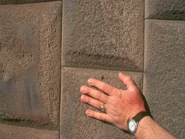
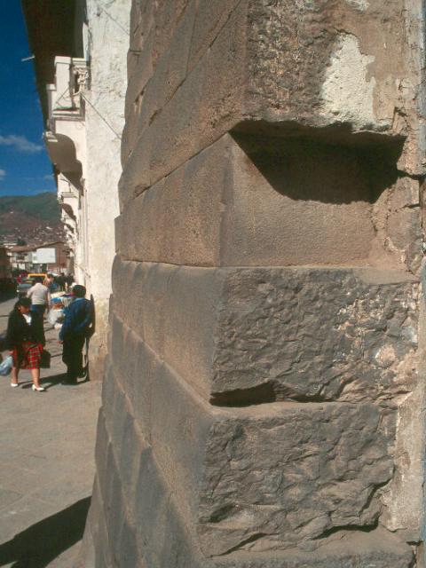
These pictures were taken in Cusco and show, again, a variety of levels of stonework and narrow streets. As at Ollantaytambo, early in the colonial era, the Spanish literally superimposed European architecture directly on the Inca walls. This has caused some structural problems in some cases, because the Inca walls were not intended to carry another story of Spanish style mamposteria, or rubble stonework. Nevertheless, as at Ollantaytambo, enough survives of the original Inca urbanization to clearly see that even in the high status districts, the buildings were tightly packed and had narrow passages between them.
Little is known with certainty about the epidemic that swept Peru just before Pizarro arrived on the coast. But Juan de Betanzos, d.1576, was, by 1544, the leading interpreter of Quechua, the Inca language, in the Viceroyalty of Peru in his day. Sometime after 1541 he married Doña Angelina Yupanque, niece of the Inca Huayna Capac. [Hemming shows her as daughter] In 1532 at the age of 10 she had married Atahualpa, the son of Inca Huayna Capac. Huayna Capac died just as the news of the Spannish arrival was being brought from the coast by messengers. Atahualpa, at the death of his father, became the last Inca prior to the Spanish invasion. A civil war ensued between him and Huascar, his brother. Doña Angelina Yupanque, whose Inca name was Cuxirimay Ocllo, was imprisoned with her husband Atahualpa Inca by Pizarro. Betanzoz learned much from her and her relatives.
Specific questions:
- How many large-scale construction projects were known to be under way at the point of Spanish contact in 1534?
- Can we realistically estimate the numbers of workers involved, using Protzen's postulations?
- Is there any way to tell if this number was significantly larger than it had been 25 years, 50 years, 100 years earlier?
- Where were they, can we map them?
- Where did the labor forces come from, where did they return to?
- What kinds of tubers and maize were grown?
- How were these stored?
- What kind of mice ate these foods?
- What kinds of fungi attacked the tubers?
- At what altitudes? At what temperatures?
- Are any diseases associated with these kinds of fungi?
- Could the outbreak have involved vectors other than mice and diseases other than hemorrhagic fever?
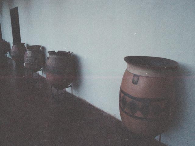
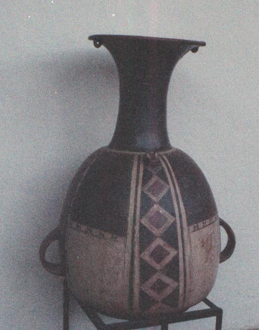
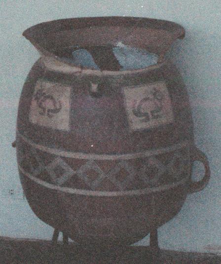
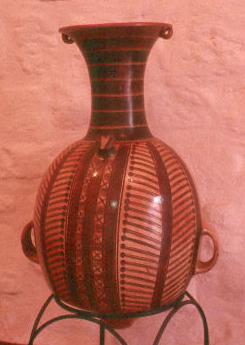
These are some ceramic storage vessels, the three photos on the left are from the Museum of the Admiral's House in Cusco, and the one on the right is from the Museum of Garcilasco de la Vega. I do not know much more about them, what periods they come from, what they were used for, but John T. might check this out while in Cusco and add more images and more to our knowledge of food storage in the period immediately preceding the Spanish invasion.
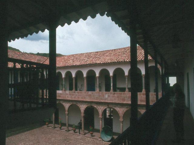
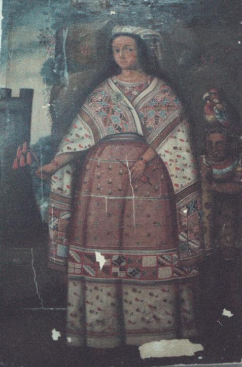

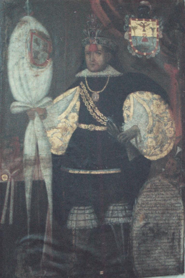
The image on the left is the patio of the childhood home of Garcilasco de la Vega in Cusco. The three portraits hang in the Museum of the Admiral's House in Cusco. I do not remember who they are and cannot find my notes. I suspect that one of them may have been Betanzos's wife. John T. might check this out and report back during his stay in Cusco. I seem to recall that there are more portraits. I had to use 1000 speed film and no flash which contributes to the poor image quality. But it might be interesting to learn if any relatives of these individuals succumbed to the epidemic we are investigating.